
Researchers Map Alaska’s Glaciers from Above
Media Inquiries
Beginning on foot, Carnegie Mellon University’s Brandon Tober(opens in new window) donned skis to survey the accessible four-kilometer lower section of Root Glacier. Tober is part of a team of researchers working to map the glacier’s thickness and bedrock elevation using two types of ice-penetrating surveys — from the air and on the ground.
The team — researchers from CMU, the University of Alaska Fairbanks, and the University of Arizona, are working in collaboration with the National Park Service at the Kennicott and Root glacier complex in Alaska’s Wrangell-St. Elias National Park and Preserve. It’s the largest national park in the United States, and draws more than 50,000 visitors every year. This region, accessible by one of only two roads in the park, offers a unique opportunity for hikers to explore the icy surface of Root Glacier.
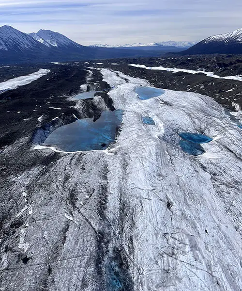
Looking beyond the park’s stunning views reveals pressing environmental concerns around the thinning and retreat of the glacier system.
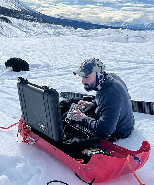
The ground approach, while limited in range, collected data on the most trafficked area of the glacier system and later served as validation for the second phase of surveys from above.
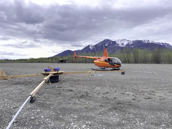
"Traditional ground-based ice penetrating radar surveys are very labor-intensive,” said Tober, a postdoctoral researcher in the Department of Civil and Environmental Engineering(opens in new window). “With a helicopter-borne radar, we were able to cover approximately 550 kilometers of landscape in three days.”
Suspended from a bright orange helicopter, the four-pronged, drone-like sensor flew over both Kennicott and Root glaciers in a serpentine pattern, using radar sounding to capture detailed measurements of the ice thickness and bedrock elevation below.
The data collected from both surveys will help predict how the glacier will evolve, construct detailed regional maps, and better understand the glacier’s marginal lakes and their subsequent threat: outburst floods.
“Outburst floods occur when dammed lakes fed by glacial meltwater are released. They can be detrimental to towns in close proximity, like McCarthy, Alaska,” said Tober. “The surveys will not only enable us to further scientific understanding of glacial retreat, but will also help to assess potential future hazards to the downstream community and infrastructure.”
The results of these surveys will ultimately help inform the National Park Service of potential hazards to existing and future infrastructure developments including roads, pedestrian bridges and trails.


